
Elene turned to the sonar display. Two scans taken less than twenty minutes apart were overlaid in different colors. The bow matched. The stern did not. It had shifted downslope by several inches. “Navigation error?” Reed asked. The technician shook his head. “Checked twice.” Elene looked back at the wreck. After two thousand years, the seabed beneath it was giving way gradually but surely.
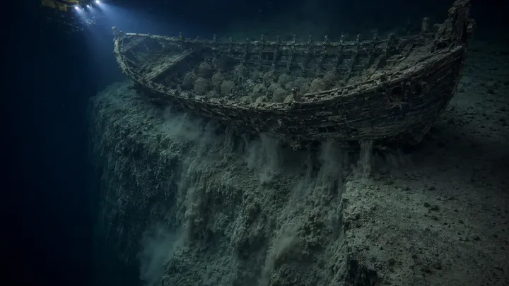
Mason sent the remotely operated vehicle around the hull while sonar built a wider map. The danger became clear. The ship rested on a sediment shelf above a steep underwater escarpment. The stern sat closest to the drop. Beneath it, channels had opened where silt had washed away. Thin streams of sediment were spilling over the edge. “How far down?” Elene asked. “Thousands of feet before it levels out.”
A patch of seabed suddenly slumped. The camera filled with gray. When it cleared, the stern sat lower. Reed exhaled. “We may need to pull out.” Elene looked at the sealed jars and cylinders. “If we leave now, we may never find it.” Reed studied her. “What can we realistically save?”